Карты бывают географические, экономические и физические и могут включать в себя метеорологические схемы осадков, речных стоков и ветров. Масштаб может варьироваться в зависимости от назначения карты. Карты наводнений должны позволять прогнозировать районы затопления и планировать защитные мероприятия. Лучше использовать топографические карты или карты с горизонтальным масштабом, поскольку данные о высоте над уровнем моря очень важны при определении рисков наводнений и планировании мер защиты. Наиболее полезны цифровые карты в сочетании с GPS.
На уровне речного бассейна создаются следующие карты:
— карты всех регионов, находящихся под угрозой затопления: карты угрожаемых регионов
— карты конкретных зон, где существует риск наводнения: карты опасности наводнений
Карты угрожаемых регионов в малом и/или крупном масштабе показывают ожидаемую территорию затопления и уровень воды для трех сценариев: сценарий с низкой вероятностью или экстремальные события, сценарий со средней вероятностью (который может осуществиться раз в 100 лет) и сценарий с высокой вероятностью.
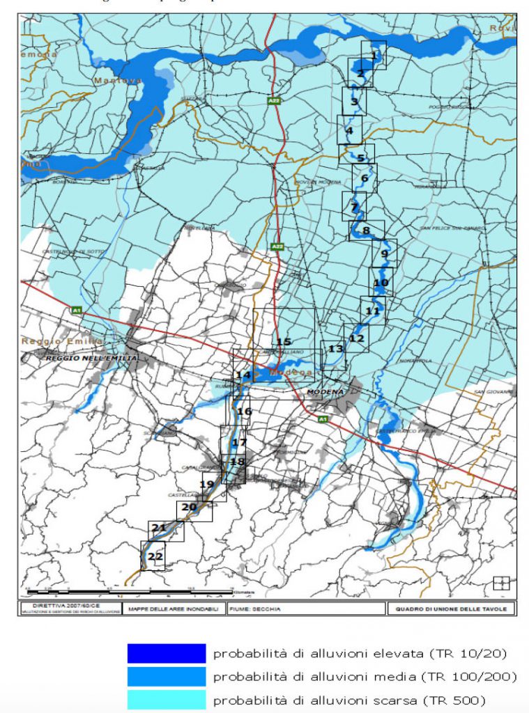
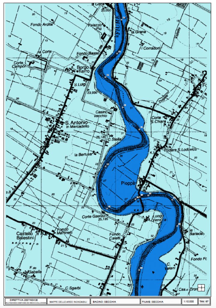
Примером может служить работа Управления бассейна реки По (AIPO) в Италии, которое уже давно и активно занимается выявлением и картографированием зон опасности наводнений по всему бассейну реки По. Управление применяет простой метод, основанный на границах исторических наводнений, определяя таким образом три различных сценария наводнений: сценарий с низкой вероятностью (раз в 500 лет), сценарий со средней вероятностью (раз в 100-200 лет) и сценарий с высокой вероятностью. (рис.12.a и 12.b).
На картах опасности наводнений для районов, затопляемых при каждом из этих сценариев, указано количество населения, предприятия и элементы окружающей среды, подверженные потенциальному риску затопления, а также дается другая информация, которая может оказаться полезной, например, о прочих потенциальных источниках загрязнения.
Эти карты используются для определения регионов, которые могут пострадать от наводнений, и возможного ущерба. На основе этих карт планируются меры по защите населения и долгосрочные мероприятия по смягчению потенциальных последствий наводнений.
The maps of the regions under threat of a flooding cover the geographical locations that can be flooded and reflect:
- floods that are less likely to occur or cases of unforeseen events;
- floods with medium probability to occur /probability of second occurrence – more than 100 years /;
- floods with high probability to occur.
On the bases of prediction on these maps, several activities with long and short term character aiming to prevent or to reduce flood consequences are planned and implemented and planes for defense are elaborated.
The maps of the regions under risk of flood show the possible negative consequences of the flood and reflect:
- a project number of population that could be possibly affected;
- type of economic activity in the region that will be possibly affected;
- installations for complex prevention and control of contamination, that may cause additional contamination due to flood-caused technical failures.
On the bases of prediction on these maps the activities for protection of the damaged populayion on regional and local level, the long and short term activities are planned. An individual plan for action at flood danger for you and your family can be prepared on the bases of these maps.
You are entitled to familiarize yourself with the maps and to receive the information you require concerning danger of flood, and if a proper organization is in place, to receive such maps or excerpts thereof.
Even more — it is the obligation of every citizen to be aware of what dangers are possible in his living location. It is especially important to familiarize yourself with the map and to check whether the home you live in, the school you study in, or your work place are located in zones in danger of flood. On the basis of that you can request information for the existing protection plan and the steps you need to undertake in case of danger, during, and after a flood.
The maps are prepared, maintained and kept by the respective institutions in a country – normally these would be the Basin directorates and Civil Protection Service.
From the map you can learn about the obligation of the local authorities for prevention from flood at sudden danger from flood.
From the maps you can learn about the obligation of the local authorities for prevention from flood risk and to insist to be implemented.
From the maps on Internet you can get orientation about the existing rivers, springs, dams and other hydro technical facilities which can cause flood.
At school you can create you own map of the danger zones from flooding for the place where you live, the way to school and at school to predict and discuss what you have to do in case of flood if you are any of these places. Before going abroad with your parents on holiday you can learn from the Internet map about the existing danger from some types of floods.
We have prepared a map of the floods all over the world on the bases of “Google Maps”.
You can look at the map and decide whether there is a thread from flood for a place you wish. You may try to make a prediction about the areas threatened by flood. The icons of Google have been used. You can add to any place threatened by flood or hurt by flood: pictures, texts, drawings, videos etc. This map can connect with GPS navigator and we can exactly to the place we want — where we live, the place we will go on holiday with our parents.
View Floods Prevention — ECRP (BG) in a larger map