Le carte possono essere: geografiche, economiche e fisiche, includendo anche diverse carte meteorologiche: per le piogge, per il deflusso dei fiumi, per i venti. Possono essere a scale diverse, a seconda del loro utilizzo. Le carte delle alluvioni devono aiutare a prevedere quali aree possono essere colpite ed a pianificare le azioni di difesa. E’ preferibile utilizzare carte topografiche o carte con Modello Digitale del Terreno, giacché è molto importante individuare le aree topograficamente rialzate qualora si verifichi un’alluvione e si debbano predisporre le misure di difesa. Le carte digitali, combinate all’uso del GPS, sono da preferirsi.
Le carte predisposte per la scala di bacino sono le seguenti:
Carte delle aree potenzialmente interessate da alluvioni: Carte di pericolosità alluvionale
- Carte delle aree ove è presente un determinato rischio da alluvione: Carte di rischio alluvionale.
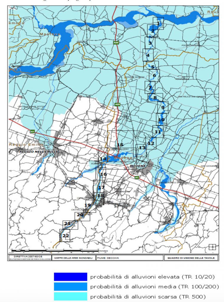
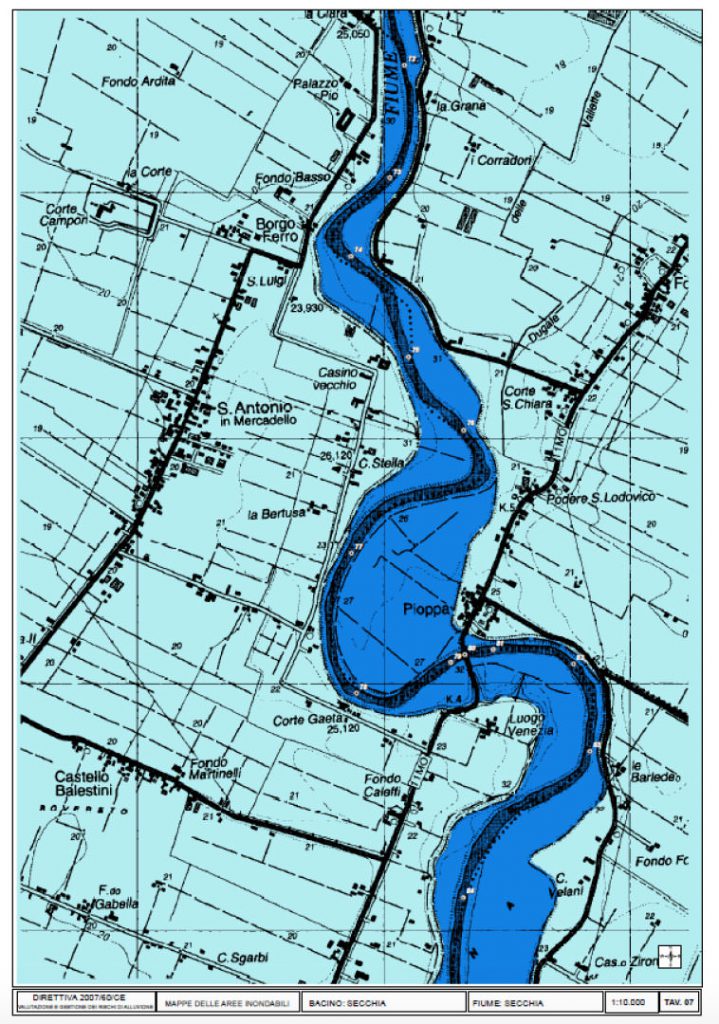
- Le mappe della pericolosità alluvionale, a piccola e/o a larga scala, mostrano l’estensione e i livelli d’acqua previsti in caso di allagamento secondo tre scenari: uno scenario a bassa probabilità o eventi estremi, uno scenario a media probabilità (con un periodo di ritorno di 100 anni) e uno scenario ad alta probabilità. C
- Come esempio di cartografia di pericolosità alluvionale in Italia, l’Autorità di Bacino del Fiume Po (AIPO) è da tempo attiva per l’identificazione e la mappatura delle aree a pericolo di alluvione dell’intero bacino idrografico del fiume Po. È stata sostanzialmente applicata una metodologia semplificata basata sul perimetro delle alluvioni storiche individuando così tre distinti scenari di alluvione: scenario a bassa probabilità (periodo di ritorno 500 anni), scenario a media probabilità (periodo di ritorno 100-200 anni), scenario ad alta probabilità. Vedere la Fig. 12.1 e la Fig. 12.2.
- Le mappe del rischio di alluvione vengono preparate per le aree allagate in questi scenari che mostrano la popolazione, le attività economiche e l’ambiente a potenziale rischio di inondazioni e altre informazioni che possono essere utili da includere, ad esempio, altre fonti di inquinamento.
Tali mappe sono usate per determinare le regioni che possono essere interessate da inondazioni e i danni che ne possono derivare. Le misure per proteggere la popolazione e le attività a lungo termine per mitigare le conseguenze della inondazioni sono pianificate sulal base di queste mappe.


The maps of the regions under threat of a flooding cover the geographical locations that can be flooded and reflect:
- floods that are less likely to occur or cases of unforeseen events;
- floods with medium probability to occur /probability of second occurrence – more than 100 years /;
- floods with high probability to occur.
On the bases of prediction on these maps, several activities with long and short term character aiming to prevent or to reduce flood consequences are planned and implemented and planes for defense are elaborated.
The maps of the regions under risk of flood show the possible negative consequences of the flood and reflect:
- a project number of population that could be possibly affected;
- type of economic activity in the region that will be possibly affected;
- installations for complex prevention and control of contamination, that may cause additional contamination due to flood-caused technical failures.
On the bases of prediction on these maps the activities for protection of the damaged populayion on regional and local level, the long and short term activities are planned. An individual plan for action at flood danger for you and your family can be prepared on the bases of these maps.
You are entitled to familiarize yourself with the maps and to receive the information you require concerning danger of flood, and if a proper organization is in place, to receive such maps or excerpts thereof.
Even more – it is the obligation of every citizen to be aware of what dangers are possible in his living location. It is especially important to familiarize yourself with the map and to check whether the home you live in, the school you study in, or your work place are located in zones in danger of flood. On the basis of that you can request information for the existing protection plan and the steps you need to undertake in case of danger, during, and after a flood.
The maps are prepared, maintained and kept by the respective institutions in a country – normally these would be the Basin directorates and Civil Protection Service.
From the map you can learn about the obligation of the local authorities for prevention from flood at sudden danger from flood.
From the maps you can learn about the obligation of the local authorities for prevention from flood risk and to insist to be implemented.
From the maps on Internet you can get orientation about the existing rivers, springs, dams and other hydro technical facilities which can cause flood.
At school you can create you own map of the danger zones from flooding for the place where you live, the way to school and at school to predict and discuss what you have to do in case of flood if you are any of these places. Before going abroad with your parents on holiday you can learn from the Internet map about the existing danger from some types of floods.
We have prepared a map of the floods all over the world on the bases of “Google Maps”.
You can look at the map and decide whether there is a thread from flood for a place you wish. You may try to make a prediction about the areas threatened by flood. The icons of Google have been used. You can add to any place threatened by flood or hurt by flood: pictures, texts, drawings, videos etc. This map can connect with GPS navigator and we can exactly to the place we want – where we live, the place we will go on holiday with our parents.
View Floods Prevention – ECRP (BG) in a larger map